This site contains affiliate links, so I might receive a commission if you click and buy something. It doesn´t cost you any extra, but I could treat myself to some extra snacks to keep me going on my outdoor adventures! Read more in my Privacy Policy
This is a linear route which follows the Riu Sec (“dry river”), running between the towns of Mutxamel and San Juan. Both ends of the route begin on the outskirts of the towns.
The Assut of Mutxamel can be accessed directly via a park/picnic area that is located in a residential area.
This hikng route can be completed on it´s own, or it can be combined with other routes:
If you are looking for accommodation close to this hiking route, I can recommend Bonalba Spa Hotel. It is just 5 minutes away by car, situated on a nice big urbanisation with bars and restaurants.
I can personally recommend the spa because I use it regularly myself! It is great to cleanse after a wild camping trip, or relax after a tough adventure.
Looking for ESSENTIAL OUTDOOR GEAR for your mountain adventures?
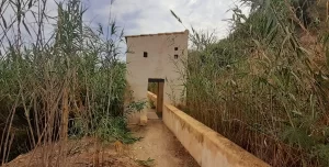
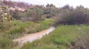
The wide river bed is largely silt and if it has rained, you will get a big layer of ´mud´ stuck to the underside of your trainers!
There are rocks that create uneven ground, and in some areas it is quite overgrown with reeds that you need to tackle.
There is water that must be crossed withreed-covered stepping stones.
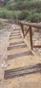
The information board shows little incline/decline in the hike. However, if you wish to visit the picnic area/park, then there are quite a few steps to climb.
If you cannot see the path straight away, look out for green/white paint, which could be on trees/posts/rocks/walls/etc indicating the official route.
Due to the terrain this route is not suitable for people with mobility issues or anybody who is unsteady on their feet.
You don´t have to be particularly adventurous, but you do have to wade through reeds and your trainers will get muddy.
Avoid the rain! Do not do this hike when it is raining, after heavy rain, or if it is forecast to rain on that day.
I completed this route in September after heavy rain because I was hoping to see the waterfall in full flow (which I did).
However:
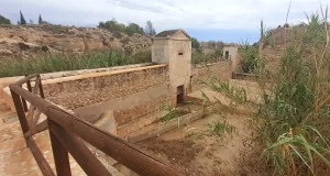
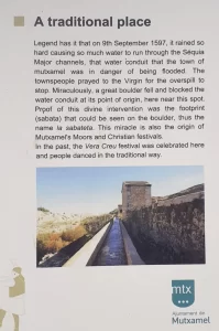
The Assut de Mutxamel is another dam near Mutxamel. The water flowing over the dam is less impressive than the other nearby dams, but the buildings that accompany it are of interest. They were a major Work of hydraulic engineering at a time when farming was of the upmost importance for the local economy.
From the Assut de Mutxamel, the route route leads you in a south-east direction towards San Juan.
This is accessed from the road via the town hall park, which is an important place because it is the original of the Moors and Christian festivals in the town of Mutxamel.
However, you can also begin this hiking route from the Assut de Sant Joan and travel in a north-west direction, away from Mutxamel town.
I parked here and started the hike from the south-east end of the route.
This is the same car park as the Assut de Sant Joan – El Cantalar hiking route because I hiked that route first, and then this one.
There is another option to park at the other end of the route, which is on the side of the road near the picnic area/town hall park (“Área recreativa cerrada con cámaras” / “Parque del Ayuntamiento”).
However, when I visited on a Saturday in September it was temporarily closed (the name does translate to “Picnic area closed with cameras”!)
There was a sign on the gate (which I had to read backwards through the faded paper) showing the Opening hours…
So, depending on when you are reading this blog, this option might be available to you.
You can follow my Assut de Mutxamel – Assut de Sant Joan route.
If you follow my route, please be aware that:
Top of the waterfall (on the way there)
Right at the beginning (at the top of the waterfall, above the Assut de Sant Joan) walk directly towards the concrete drain, and then to the river, where you will find one rock to help you cross the river.
Then turn left at the end of the grass…
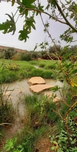
Stepping stones
There are some big sturdy stepping stones. However, the final rock moves to be careful not to fall in!
There is one area that is prone to flooding, which begins at the first bridge.
Big tree
Just before the first bridge, you can take a detour.
Up this path you can find an old car becoming at one with nature (look through the fence on your left), and “Pino del olino o pi del moli”, which is a big tree planted in the 1800s.
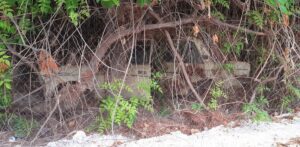
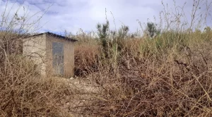
Small building
When you pass a small building on your left, the path temporarily disappears.
Ignore the recording of my route, because I went in circles looking for the path.
However, do pay attention to the satellite image of my route as you follow it, because here you can actually see white path, which is the correct way to go (next time, I will do that too!)
More stepping stones
Look out for a green/white painted post. On the right there are some stepping stones hidden the bushes on the right to cross the river.
At the bridge
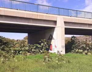
As you approach a big bridge look out for the path:
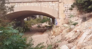
Graffiti
You may have seen this graffiti from the AP-7 road, but it is not possible to admire it while driving past. It is pretty impressive up close.
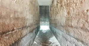
Tunnel
As you approach the Assut de Mutxamel buildings you will see a tunnel to the left, which looks like an old water channel tunnel.
TOP TIP for Adventurers: You can enter this tunnel.
I went with a torch and walked as far as the first light, which was actually a small ´window´. There were lots of geckos, but no other animals. How far can you go?
If you love going undergound (like I do) then I can personally recommend this guided tour of the Canelobre caves in Busot with transportation from Alicante.
These are definately the most impressive caves that I have ever visited! They are also situated high up on the side of a mountain with incredible scenic views.
Assut de Mutxamel (buildings)
TOP TIP for Explorers: There are lots of little areas that you can go and explore, such as two small buildings, walking through the exposed water channel, and going down to look through the arches.
Remember to look up!
Guided visits
Some future guided visits were advertised:
The year was not printed on the posters, but the dates match up with Sundays in 2024.
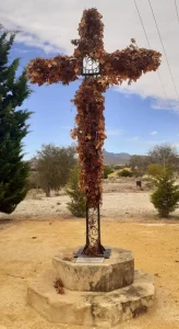
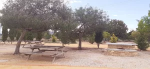
Picnic area “La Sabateta”
From the Assut the Mutxamel you can walk up 72 steps to reach the picnic area and park. I did this and it was worth it for the view, and the extra little walk around the park.
If you want to have a picnic here there are 11 picnic benches.
However, I couldn´t leave this area to explore any further because I was locked in!
Top of the waterfall (on the way back)
It is possible to take a small short-cut to avoid walking at the top of the waterfall (above the Assut de Sant Joan) on the way back.
Instead of using the big sturdy stepping stones and crossing the river again on the other side of the bridge, you can take a short-cut under the other side of the bridge.
When you reach the grassy area, follow it around to the right as much as you can (where the graffiti is under the bridge).
This will lead you right back to the car park.
From the Assut de Sant Joan, you can also begin another linear route: El Cantalar – Assut de Sant Joan (SL-CV 156).
There is a third route that is also linear, and continues to the north-west of the Assut de Mutxamel…
I attempted to do this route in September, but I wanted to it separately to the others.
It was not possible to do it from the Assut de Mutxamel (due to the picnic area being temporarily closed), so I attempted to drive to the other end of the route and begin from there.
I attempted to drive to where I thought the route ended, but reached two chain barriers blocking vehicular access from both directions.
So, I parked near a chain and walked towards the end of the route.
From there I could see a green/white painted post on the hilltop indicating the official end of the red route (Assut de Mutxamel – Lloma Ramos), but I couldn´t access it due to fencing, and an area resembling the beginnings of a building site with the ground had been dug up with large plant machinery.
So, do not try to hike from here!
Recommended hiking options:
For a shorter route…
For a longer route:
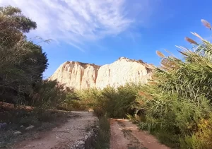
“Confluencia Riu Montegre & Riu de la Torre”
This is located about 1km west of the far end of the green route (Assut de Mutxamel – Assut de Sant Joan).
From the end of the green route, it is not possible to continue hiking along the mountain in order to reach due to fencing over the top of the hill (which had appeared possible on the map).
However, there is a possibility that you can…
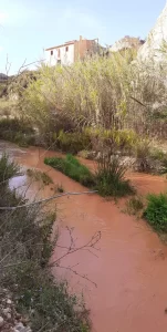
This ´route´ is not on my hiking map but canyons are often used as unofficial paths (if not too overgrown).
I drove to the Confluencia Riu Montegre & Riu de la Torre in an attempt to try it. However, the area was so flooded with pink water that I couldn´t even walk on the vehicle tracks!
So, stay well away if it has rained!
Wild Child Costa Blanca
