This site contains affiliate links, so I might receive a commission if you click and buy something. It doesn´t cost you any extra, but I could treat myself to some extra snacks to keep me going on my outdoor adventures! Read more in my Privacy Policy
The Ruta del Agua Sella is a circular hiking route, also known as the Ruta de l’Aigua in Valencian.
It is a quaint little route that largely follows the River Sella and is situated in the valley just below Sella town.
There is an “official” Ruta del Agua Sella hiking route (the SL-CV 112), which is a very short and easy route around the eastern side of the town´s waterway. This is delightful, despite walking largely on the road surface, but a bit too short for me.
However, there are longer variations of the Ruta del Agua Sella, including this one, which includes the three main locations for wild swimming, as well as some other potential pools, and even a wild camping area.
Therefore, it is perfect for anybody who wants a little adventure along the way.
Heed help HOLIDAY PLANNING and finding the BEST GUIDED TOURS in the Costa Blanca?
Recommended gear for running:
GARMIN Forerunner 225 Running Smartwatch (Navy)
With GPS, Garmin Pay and 2 week battery life
This version of the Ruta del Agua Sella consists of:
The Ruta del Agua Sella includes:
Any normal hikers who are used to walking this distance will be fine doing the Ruta del Agua Sella.
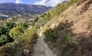
The main route is fairly easy, although not completely flat.
Therefore, it is not suitable for wheelchair users or anybody who struggles with an incline/decline.
You can do the Ruta del Agua Sella hiking route hike any time.
Summer is ideal if you want to visit to include the wild swimming spots.
However, in hotter weather it could be a little difficult walking on the stretch of country road since there is no shade. There is shade along the other parts of the route though.
After some rain would be better, since it will add to the various water features.
For example, some parts of the “river route” looks a little sad compared to 2 years ago, when it was alive with a flowing river and waterfalls, and flourishing with green plants and grass.
2024 has been a dry year in Sella, and the ideal time to visit would be after a long period of rain, and then sunshine to replenish the plant life too.
In particular I would love to see water flowing over the Assut del Salt de Sella (the Sella dam) again.
Regardless of this, the Ruta del Agua Sella is still a pleasing hike on a historical journey through a charming area.
There are several places where you can park to join the Ruta del Agua Sella hiking route:
I usually try the public carpark first, and if that is full, then I try the on-road parking.
Do not park here
It appears to be a carpark, and even has a big “P” parking sign at the entrance. However, it is not a public carpark. Inside there is a smaller notice (in Spanish) stating that the parking is only for the Town Hall, and the nearby garage.
You can follow my hiking route to do the Ruta del Agua Sella here.
Want to visit another WATERWAY near SAN JUAN with a MASSIVE WATERFALL?
To do the Ruta del Agua Sella hiking route from the public carpark, simply walk up the hill and follow the country road around to the right.
You are now entering the Barranc de l’Arx hiking area.
From here, I followed the road in the direction away from the town.
Quiet country road
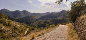
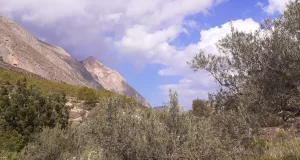
The first part of the Ruta del Agua Sella is largely on quiet country road (this is where the only car passed me). This area is very beautiful, with swallows flying overhead and a great view of the giant mountains ahead, as well as the valley below while you gain height on the road.
Alternative country road route
I realised afterwards that there is an alternative route (shown on an information board as the green route!) when beginning the Ruta del Agua Sella hiking route from the carpark.
It will make the route slightly longer, but it looks more appealing because the path is higher up, so you will have even better views!
It ascends on a country road, but the descent involves:
(Google Maps™ mapping service is a trademark of Google LLC and this blog is not
endorsed by or affiliated with Google in any way)
At the end of this track you will rejoin the Ruta del Agua Sella road that I took.
Pont de L’Alcantera (bridge)
Just before this bridge there is a water tap. It is “no potable” (not drinkable), but you can use it for a dog to drink, or to wash your hands.
Dogs are welcome to do the Ruta del Agua Sella hiking route too!
The Pont de L’Alcantera is a small single-arch bridge with an information board.
However, in September 2024, it was quite overgrown and I couldn´t see it very well.
Area Recreative de Sella (Picnic area)
On the next bend of the road is a nice little picnic area with four benches.
This is the only picnic area on the “official” Ruta del Agua Sella hiking route, which can only be accessed on foot.
However, there is a second picnic area on this version of the hiking route, and this one has parking.
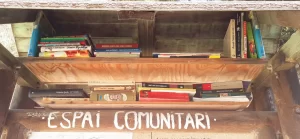
It also has a “biblioteca” (a book swap facility) if you look above the noticeboard! Cool, eh?
TOP TIP for Adventurers: If you like wild swimming in secret places read more about this pozo here.
Font de l´Alcántera (natural spring)
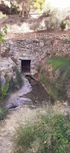
Right opposite the picnic area there are some steps leading down to the “Font de l´Alcántera”.
This a lovely natural spring on the Ruta del Agua Sella hiking route, with water that is known for its purity and its medicinal properties. However, there is no tap, so you will have to collect water straight from the “stream”.
In September 2024, the water was running slowly, which leads to a beautiful natural pool…
Pozo junto a Fuente l´Alcantara
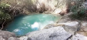
The “Pozo junto a Fuente l´Alcantara” (well near the Álcantara spring) is a well-kept secret: a pretty little pool nestled away in the bushes.
It is a true hidden gem on the Ruta del Agua Sella hiking route, but even some hikers don´t realise that it is there.
Recommended gear for hiking:
Aluminium Hiking Poles
Lightweight, durable and folding (4 colours available)
Flat road
After a refreshing drink or dip in the pool, you will continue the Ruta del Agua Sella on the flat road for about 20 minutes.
When you reach a fork in the road, you must veer left (even though it really seems like you should veer right!)
Short section of forest path
Turn right when you see the wooden “SELLA” signpost. It feels like you are trespassing, but you are not! This is the official Ruta del Agua Sella hiking route.
At the house, turn right and follow the path down to the building…
Molí de Baix
“Molí de Baix” is an old flour mill, which appears to be used as a private home now.
Here you will see a man-made “pool” of water, but don´t get excited…you cannot swim in this! It is a pretty feature on the Ruta del Agua Sella hiking route though.
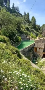
However, below the mill there is a natural pool with a waterfall that you can swim in if you are adventurous…
Fuente
The Fuente is a natural pool that can be seen from the Ruta del Agua Sella route, immediately after you pass the mill building.
However, you cannot access it via the steps since the owner displayed signs stating that people cannot enter.
TOP TIP for Adventurers: If you like cliff jumping and climbing up ropes then there is another way in and out of the pool!
Read more about the Fuente here.
Assut del Salt de Sella
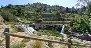
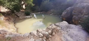
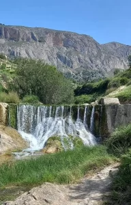
The “Assut del Salt de Sella” (Sella waterfall dam) is located just after the natural pool, to the right of the path.
In September 2024 the “waterfall” was dry, although there was some water in the pools below.
However, when I visited in May 2022, the view was incredible, with water gushing over the dam in the foreground, with the scenic mountain landscape in the background.
Interested in a white water rafting adventure down the River Júcar?
“The wild part of the route”
If you look to the left on the dam, you can see the signpost that states “PONT VELL 0.6km”. From this sign until the bridge, I have named “the wild part of the route”!
This is the official Ruta del Agua Sella hiking route, but has become very overgrown! Consequently, it can be a challenge (but I like a challenge).
In general, you simply walk in the direction of the sign and keep going.
It is impossible to get lost, because you follow the river/stream, which has high land at both sides.
Even if you cross the stream by accident (because it can be deceiving), you will soon realise and can return to go the other way.
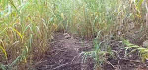
However, you can follow these directions if you want to make sure:
Warning! This area is muddy (including when I visited in June!)
(as you follow the wall, ignore the two gaps in the bushes and the broken bridge on your left. You don´t cross there)
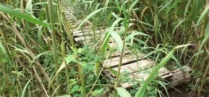
You will pass under the Pont Vell bridge, then ascend the stairs up to the single-arch bridge where you will get a lovely view of the big bridge from the other side.
The “normal” Ruta del Agua Sella hiking route is now resumed.
HOW TO AVOID: The wild part of the route
If you want to avoid wading through big overgrown reeds and slipping on wet mud, then you can leave my the Ruta del Agua Sella route temporarily, but then return to it at the end of the “wild part of the roue”:
Pont Vell bridge and stone bridge
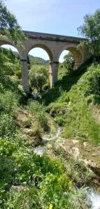
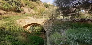
“Pont Vell” is a three-arch bridge, a prominent sight in Sella.
Just after it is a pretty little single-arch stone bridge (which you cross as part of the Ruta del Agua Sella hiking route).
To get a decent photo of the arch, there is a good spot just to the left of it, on a little grass area with 1 tree.
“River route”
From the bridge, you continue walking towards the west. I have named this the “river route”.
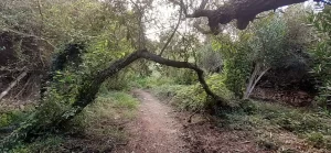
This part of the Ruta del Agua Sella consists of a natural path that runs through a narrow stretch of forest area.
It follows the river/stream and the land is high at each side (so it is impossible to take a wrong turn).
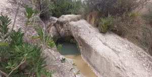
Along this stretch you will see natural pools and the famous stepping stones…
Natural pools
These consist of…
TOP TIPS for Adventures:
Stepping stones
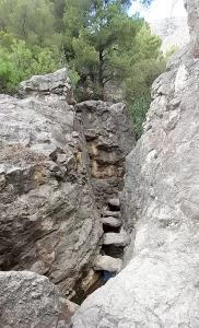
There are some legendary stepping stones hidden away at the end of this stretch of path, just before you ascend up to the town and leave the Ruta del Agua Sella “river route”.
It does require a small detour off the path: When you reach a tall silver post with a camera on it, and a small building, walk between the two things because that is the path towards the stepping stones.
However, they are not normal stepping stones (placed in water). They are actually seven wide rocks situated in a tunnel with tall rock “walls” on either side.
TOP TIP for Adventures:
The “tunnel” containing the stepping stones leads you to a river/stream with a waterfall a little further upstream.
Want to walk through water? Read more about this river/stream here.
Font Mayor
“Área recreativa Font Mayor” is a picnic area, man-made pool/dam and old camping ground, which would be great for wild camping!
It is not part of the official Ruta del Agua Sella hiking route, but absolutely worth the 5-minute detour!
To the left you will pass the pool, and then the raised campground land.
To the right you will see some (old?) facility buildings and a few picnic benches. However, you need to climb several sets of steps to access these.
TOP TIP for Explorers:
In this (Font Mayor) area there are apparently “coves near the pool with blackened ceilings smoked by bonfires lit by mule drivers and shepherds”.
I have no idea where these are because I only read about it afterwards, but I´d like to find them!
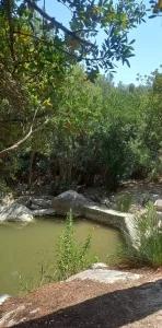
If you visit the Font Mayor pool, you will find an abundance of wildlife, such as shrimps, frogs and dragonflies!
It is also a great place to rest in the shade on a hot day, or have an informal picnic on the concrete area beside it.
TOP TIP For Adventurers: If you like wild camping, there are some interesting opportunities at Font Mayor. Read more about it here.
From this area, you follow the road that passes along the bottom of the town, all the way back to the carpark.
On this road, to finish off the Ruta del Agua Sella, there are a few final interesting features to see..
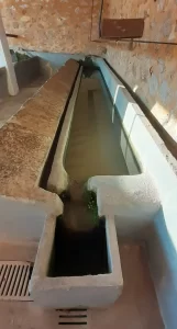
Lavador
You can see a historical landmark “Llavador públic de Sella”, is an old-fashioned laundry room.
Viewpoint
There is a viewpoint looking down into the valley that encompasses the Ruta del Agua Sella, accompanied by an information board.
Footpath
There is a footpath leading from the town/bar, to meet the Ruta del Agua de Sella below.
Rest stop
There are some new benches with a sparkly new water fountain tap where you can have a rest and refresh after your Ruta del Agua Sella hike.
Looking for ESSENTIAL OUTDOOR GEAR for your mountain adventures?
There are picnic benches in two locations along my Ruta del Agua Sella hiking route:
1. The “Area Recreativa de Sella” (Sella picnic área).
This is very close to the Font del l’Alcàntera, from which you can collect drinkable water, situated on the opposite side of the road.
There is no parking here or close by. Therefore, it is nice, quiet and clean because it is only used by hikers passing by.
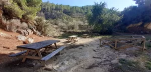
2. “Área Recreativa Font Mayor” (Font Mayor picnic area)
The picnic area is situated on the right-hand side.
However, you have to walk up several sets of steps to access them.
TOP TIP for Explorers: I haven´t walked all the way up these steps, because there were some people having a picnic at the first picnic bench with a hammock obstructing access. But you should find more benches further up.
There is a barrier preventing vehicle access into this area.
However, just before the barrier on the right there is there is a small gravel area which can accommodate a few cars.
If you want to extend the Ruta del Agua Sella hike to make it longer and more mountainous, then you could also follow one of these blue or red routes…
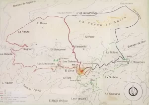
If you choose to park at the “aparcamiento Ruta del Sella” to visit the Fuente, or decide to avoid the wild part of the route (on the road which passes this car park), then you can go and have a look at the “Bassa del Batle” This is an enclosed water basin which appears to have an accompanying information board.
I haven´t seen it, but I spotted it on the map showing my route while writing this blog!
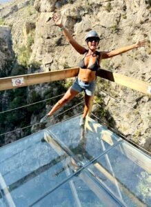
If you are visiting Sella, then you should definately visit the thrilling Relleu walkway with glass-bottom viewing point!
I have done it myself (twice) and personally recommend it!
If you like cycling, then you can enjoy a 30km Costa Blanca downhill bike ride down Aitana mountain (with transport from Sella as well as other nearby towns). it is an all day event, with the option to have lunch and a visit to a bar afterwards before heading back.
Why not buy me a coffee
to keep me going on my adventures
so that I can share them with you!
Wild Child Costa Blanca
