This site contains affiliate links, so I might receive a commission if you click and buy something. It doesn´t cost you any extra, but I could treat myself to some extra snacks to keep me going on my outdoor adventures! Read more in my Privacy Policy
Very close to the town of Aspe, in a south-east direction towards Elche reservoir, there is a beautiful area with breathtaking views.
Los Algezares is a “Paraje Natural Municipal”, which translates to the Municipal Natural Landscape. Los Algezares Aspe is perfect for hikers, trail runners, people who like to explore, and mountain bikers.
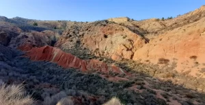
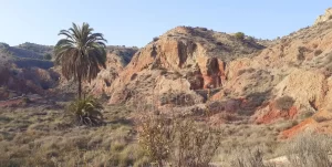
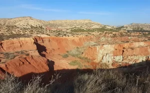
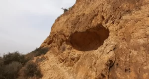
The landscape is canyon-like with incredible rustic colours and rock formations that transport you to another planet.
My route involves visiting:
There is also a viewing point and picnic area in the main area of Los Algezara Aspe which you can visit, either as part of the hiking route, or as a standalone visit.
Looking for ESSENTIAL OUTDOOR GEAR for your mountain adventures?
This article is centred around a 9.65km route from Aspe town to Los Algezares natural landscape. However, there are also other suggestions, such as:
For hikers, there are lots of interesting features to see and explore in and near Los Algezares Aspe.
For trail runners, there are an abundance of trails and wide gravel tracks allowing you to safety run while enjoying the views.
For mountain bikers, there are two dedicated mountain biking areas with slopes and ramps, as well as the wide gravel tracks to explore the wider area.
Recommended gear for cycling:
Cycling set: Jersey and pants (unisex)
Windproof for autumn
and winter seasons
This route begins near Aspe and heads towards Los Algezares Aspe.
The terrain in the mountain biking area is varied.
I hiked on the easiest route, which involved a few small “slopes” to ascend/descend.
However, there was also one steeper section that was unavoidable, but it only took a few minutes to descend.
Therefore, you must be prepared to descend on a steep dusty track or go down on your bum!
Or you can take a short detour from my route and avoid the steep part.
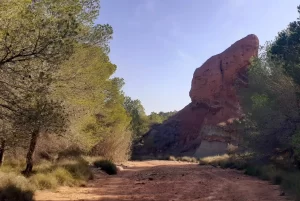
Once you leave the mountain biking area, the path becomes a big wide, flat, gravel track.
You need to use your hands to get down into the barranco, and there are initially a few big rocks to get past, but after that there is a normal hiking trail.
Once you exit the barranco, and enter the Los Algezares Aspe area, it is easy walking again.
Hiking through the mountain biking area and the barranco is not suitable for people with mobility issues.
It is great for dogs. I had a doggy with me…just be careful it doesn´t pull you down the steep bit!
However, you can avoid the longer hike, and drive directly to the car park in the centre of Los Algezares Aspe to visit some of the main sights, do a shorter hike, enjoy the views, or have a picnic.
I suggest avoiding the barranco de los ojos and the mountain biking areas during or after rain.
The ground of the mountain biking area appears silt-like and would likely stick to your footwear in big clumps!
The barranco de los ojos could have water in it, which would be unavoidable due to it´s narrow nature.
During/after heavy rain, there could even be water flowing under the Puente de los 5 ojos in Los Algezares Aspe.
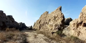
There are 3 parking options, all close to each other in Aspe, where you can park on the side of the road to follow my hiking route to Los Algezares Aspe:
You can follow my hiking route to Los Algezares Aspe here.
On the app, you must mark the route as “available offline” in advance, because there is no signal in the barranco (although there was a signal in the other areas).
In the mountain biking area you don´t have to follow my route since there appear to be many different route options.
For example, on the left side there are hills, which you could ascend for a better view down to the barranco and land on the other side.
These are mainly big slopes for mountain bikers, but the area can be used by hikers too.
Warning! Make sure you don´t get in the way of the mountain bikers, because their bikes can appear around corners or down hills very quickly!
Travel insurance is important while adventuring in Spain in case you do have an accident!
Prefer WILD SWIMMING along a “Ruta de Agua” in Sella?
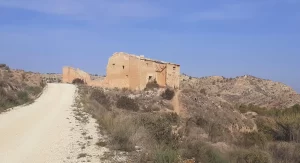
From the main road, you will begin the route to Los Algezares Aspe by walking down the smaller country road, where you will see the old house ahead of you.
“Casa Upanel”
There is an old house (ruin) on the country road. There wasn´t anything interesting to see inside but it looks pretty in a photo!
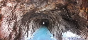
Old Tunnel
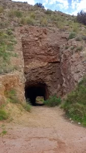
There is a hidden tunnel, which is not very well-known but absolutely worth a visit!
I accidentally took the long way there, entering via the far end of the tunnel, and then exiting at the nearest end because I was distracted by the views, and missed the path I was supposed to take!
However, there is a direct route if you walk from here directly to the tunnel that starts here.
This tunnel technically isn´t quite in the Los Algezares Aspe area. However, there is another tunnel which is inside of the area and is very similar with the path running through it.
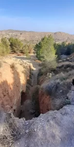
Avoid the steep part
If you want to avoid the steep part previously mentioned, you can take a different path to mine that begins here (at the eastern end of the tunnel) that leads you in an east/south-east direction where you will meet my route again here.
I haven´t walked this part of the route myself, but it appears to be a clear route on the map.
It will make the route to Los Algezares Aspe slightly shorter.
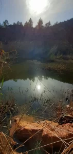
“Charcas del Paraje de los Ojos“ / “Lago Busi” (Lake)
There is a small lake located here (“charco” means pool or puddle in Spanish).
You cannot see it from the path, so you will need to walk wild, just for a few minutes, to look down on the pool.
On my route, I tried to access it from above. It was quite steep to descend, and when I got to the bottom it was too muddy and there were too many reeds.
Further along the main path, there is a smaller wilder path leading to the pool lower down.
TOP TIP for Adventurers:
If you scramble up the little slope ahead of you, you can get a closer look at the pool from there.
This would also be a great place for a snack break (facing the sun and pool), or even wild camping.
You can access the pool from here in 2 areas, but it isn´t easy, due to the sloped land and the masses of reeds.
Unfortunately, it is not suitable for wild swimming!
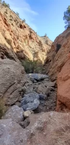
“Barranco de los ojos” (canyon)
Initially, this doesn´t look like a path because you must use your hands to climb down a little into the barranco, then pass a few big rocks.
However, the trail then becomes a clearer but narrow. After that, it becomes a much wider gravel track leading you into the Los Algezares Aspe area.
If you are mountain biker, then this part of the route is not ideal…
It is not possible to cycle this part. However, it is definitely worth carrying your bike for a short while in order to access the area at the other side (I have seen mountain bikers doing much crazier things than this, so I am confident that it is not an issue, as long as it is not an electric bike!)
Once in the Los Algezares Aspe area, the opportunities for exploring around the reservoir by bike are awesome!
Want to visit a MAGICAL ROCK ART MUSEUM hidden away in the mountains?

“Puente de los 5 Ojos” (bridge)
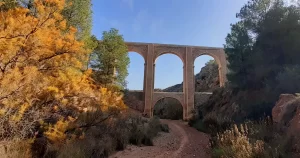
Here you will find the iconic “Puente de los 5 ojos” (bridge with five eyes), which is the bigger of the two bridges in this area. The hiking route actually goes under the bridge.
I took a right here to leave the Barranco de los ojos.
However, you could take a left instead, to visit the:
When you ascend out of the Barranco de los ojos, you will arrive at a big open space with car park, which is right in the middle of the Los Algezares Aspe area. If you prefer to, you could drive directly here to visit just to see the sights and/or to do a shorter easier walk.
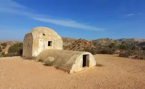
“Garita de Registro de agua”
The “Garita de Registro de agua” is situated here, very central in the Los Algezares Aspe area.
It translates to “Water registration/log box”, and you can get inside through the door at the back.
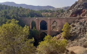
“Puente de los cuatro ojos” Mirador (viewing point)
This is also very central in the Los Algezares Aspe area.
On the other side of the road, there is a “mirador” (a viewing point) from which you can see the “Puente de los cuatro ojos” (bridge with four eyes), which is the smaller of the two bridges in this area.
At the viewing point there is a single bench, an information board, and no shade.
There is no route under the Puente de los cuatro ojos bridge. There are signs prohibiting access, and I could see water.
RETURN ROUTE
The return route is largely walking on the road in, which is a wide, flat, gravel track.
“Casa de la Monfortera”
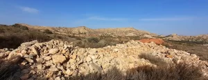
I was hoping to see another ruin here, but Casa de Monfortera is just a pile of rubble.
It definitely is not worth going out of your way to visit, and the road is not very interesting terrain.
However, walking along here provides you with stunning views down into the rusty coloured valley below, and it Is not a busy road at all.
Looking for GUIDED TOURS to visit HIDDEN GEMS in the Costa Blanca?
This road is long and will lead you out of the Los Algezares Aspe area.
Back on the trail
You can take a break from walking on the road and get back on a hiking trail here.
Recommended gear for all activities:
Thermal Water Bottle (400ml – 1.5L)
Durable stainless steel with magnetic lid
(10 colours availlable)
If you prefer just to visit the sites, and skip the hiking route, you can drive straight to the car park here, which is right in the middle of the Los Algezares Aspe area.
From here, you can easily visit the:
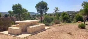
I highly recommend that you cross the reservoir here and visit these sites, also within the Los Algezares Aspe area:
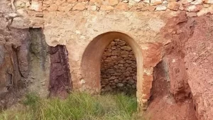
This is just off the path, but there is a small trail from which you can access and enter it
This is quite similar to the tunnel closer to Aspe.
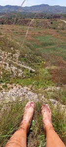
From here, you can see the northernmost part of the reservoir. It is usually dry and more like a sea of reeds, but it is an impressive sight, nonetheless.
When I discovered this, it was a very pleasant surprise! I sat here, took my shoes off (because I had walked from the dam), and I had lunch perched on a rock (careful not to lose my shoes down the cliff below).
Check out the mesmerising video here to see these sights from the sky!
TOP TIP for Explorers:
If you are feeling more energetic, you could hike up the hill to the Mirador de Los Algezares.
I haven´t been up here myself, and I haven´t seen any photos taken from there. Go explore!
Warning!
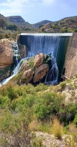
If you are planning on visiting the Elche reservoir dam, it is NOT possible to drive from this car park, even though it is just a little further south of Los Algezares Aspe.
Your GPS/sat nav may show you that you can drive down the western side of the reservoir to get to it, but you definitely cannot!
In fact, your GPS/sat nav might even show you that there are two possible options, but both are not possible:
The first time I visited the reservoir, this happened to me!
I have also seen other cars attempting to drive this way while I was walking there.
This is also a flooding area, and I have seen a 4-wheel drive stuck in the mud there!
The actual route to the Elche reservoir dam is about 25 minutes away in a car because you need to leave the Los Algezares Aspe area, and go to the main road, to enter the countryside again further south.
Interested in short walks to beautiful waterfalls?
There are lots of hiking paths in this area. For example:
However, it is spectacular! The mountainous area on the north-eastern side is lesser-visited and wilder, with snakes (if you are quiet enough to sneak up on them), and lizards the size of crocodiles running between the bushes, which made me feel more like I was in a jungle!
There are two mountain biking areas:
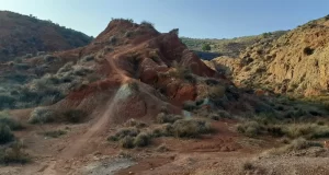
Circuito Upanel
The Circuito Upanel is an official area for mountain bikers located just west of the Los Algezares Aspe area.
It has some big steep slopes, as well as the adjoining mountain.
From Aspe area, you can begin your adventure here.
If you want to go along the mountain (to get a good view of the circuit below), you can go up or around this mountain (“La Mesa de Piedra”: The Stone Table), towards La Tierra Roja (The Red Land) and then to the Colina del Dragón (Dragon Hill). From here there is a BIG hill down! Then you could explore below and end at Casa Upanel.
The landscape is outstanding, so it is well worth taking this mountain route first!
Although, I saw people descending from La Tierra Roja down towards the circuit.
Here is a similar (4.16km) route that I did on foot. However, there is much more to explore on a bike!
Unofficial mountain biking area
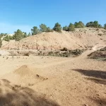
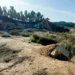
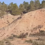
From the road just after Casa Upanel, you can access the next mountain biking area here, from which the route is obvious.
Here there are various slopes that you will see ahead of you as you enter the Los Algezares Aspe area.
There are also various ramps, which have been make with wood or by digging into the land.
There were some mountain bikers here doing tricks over ramps, and seeing how fast they could do down certain slopes.
As well as the dedicated mountain biking areas, there are wide gravel tracks that run through the area, which facilitate easy biking with incredible views!
Very close to Aspe, but on the other side of the main road, there is a small archaeological site (“Yacimiento Arqueológico de Las Tres Hermanas”: Three sisters’ archaeological site) up on a small mountain.
You can park here and visit this as part of a 1-hour hiking route across the “Tricumbre de Las Tres Hermanas” (Trisummit of three sisters).
You can follow my route here.
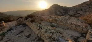
I descended down behind the third hill because I really wanted to investigate the building and land on the eastern side (it was a shooting area, just as I suspected).
However, this involved a scramble down after the third hill, so if you want to avoid this then you will need to return over/around the hills to get back to the same path.
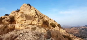
TOP TIP for Adventurers:
If you like wild camping, then the middle hill would be suitable for a quick overnighter.
The second hill could accommodate one tent, and the third hill has flat spaces on the top that could accommodate 2-3 tents.
However, there was loud music coming from the houses situated below the third hill, so I would avoid camping there.
Recommended gear for winter activities:
Heated Vest
With 3 adjustable temperature levels and 9 heating areas
Looking for a unique immersive dining experience? Dine with hosts in their own home.
For example…
…or buy a gift card here
Why not buy me a coffee
to keep me going on my adventures
so that I can share them with you!
Wild Child Costa Blanca
