This site contains affiliate links, so I might receive a commission if you click and buy something. It doesn´t cost you any extra, but I could treat myself to some extra snacks to keep me going on my outdoor adventures! Read more in my Privacy Policy
This is a route which runs along the Riu Sec (“dry river”) that flows between the towns of San Juan (Sant Joan) and El Cantalar. The ends of the route do not actually begin in the towns, but on the outskirts.
The Assut de Sant Joan is actually located right next to a main road but it is easy to drive past without realising that it is there.
It is a linear route, unless you choose to take the the wild way on the way back.
This hiking route can be completed on its own, or it can be combined with another route:
If you are looking for accommodation close to these hiking routes, I can recommend Bonalba Spa Hotel. It is just 5 minutes away by car, situated on a nice big urbanisation with bars and restaurants.
I can personally recommend the spa because I use it regularly myself! It is great to cleanse after a wild camping trip, or relax after a tough adventure.
Looking for ESSENTIAL OUTDOOR GEAR for your mountain adventures?
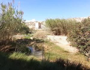
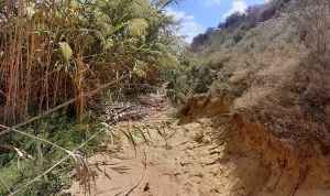
The path alongside this river bed consists of silt with rocks and some uneven ground. There are two areas in particular where the path is quite overgrown with reeds that you need to tackle. Then there is the wild way back, which is even more overgrown!
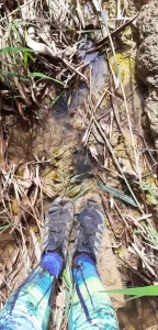
Stepping stones must be used to cross one part of the river, and even in dry times there is at least one part of the route that is wet and muddy underfoot.
I know because I did one part of the hike in June.
If you do the route after it has rained, you will have to walk through water at the secret dam and get wet feet!
Although the information board says that there is no incline/decline, it is not quite accurate because there are sloped paths to get in and out of the canyon.
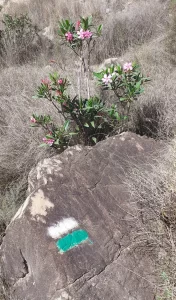
If you cannot immediately see the path, look out for green/white paint. This could be on a rock/tree/wall/wooden post/etc. These indicate the official route.
Would you like to discover the short hiking route to visit the 3 ANNA WATERFALLS?
Due to the terrain this route is not suitable for people with mobility issues or anybody who is unsteady on their feet.
You don´t necessarily have to be ´adventurous´, but you will get reeds in your hair and mud on your trainers.
Recommended gear for awesome adventures:
All Terrain Electric Scooter
Lightweight with speed up to 60km/h
Do not attempt to do this hike if there is a chance that the route is or could get wet. I recommend that you avoid it when it is raining, if there has been any heavy rain recently, or if it might rain on that day.
I did this route in September 2024 after heavy rain because I wanted to see an impressive waterfall.
The waterfall was great, but:
I also did this route in the height of summer (in June 2024). Even at this time, there was one (very short) area in particular which was wet and muddy, and rather difficult to get through due to the overgrown reeds covering the path.
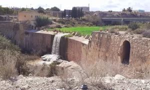
The Assut de Sant Joan is a dam located north-west of San Juan town (“Assut” is an Arabic word that means dam, and “Sant Joan” is Valencian for San Juan).
It was constructed so that the farmland could be extended towards the town of San Juan and Cabo de Huertas, with water being distributed through irrigiation channels.
It is wild, eroded, and full of riverside vegetation. It certainly doesn´t feel like a busy town is just a short drive away!
You can park directly next to it, in a gravel car park which has an information board about these routes.
I drove past this place many times in the past, and didn’t realise that there was a beautiful waterfall hidden there until I decided to check out the hiking route!
From the Assut de Sant Joan, the route leads you south-east towards El Cantalar, although there is nothing of real interest at the other end, just a gravel area and an information board on a country road.
The car park near the Assut de Sant Joan is just off the main road (CV-800).
If you are driving from Alicante direction, you can pull straight into it. However, if you are driving from Busot you will have to drive past it, get onto the main road, and return using the roundabout to get into it (because it is on a one-way road).
You can follow my Assut de Sant Joan – El Cantalar route.
If you follow my route, please be aware that:
Assut de Sant Joan
First of all, you can check out the dam buildings near the car park.
Warning! Don´t bang your head on the doorway like I did (I am only 165cm tall!)
If you travelling to the Costa Blanca, make sure you get insurance in case you do hurt yourself!
From here you can get a good view of the waterfall.
if you prefer to go on a get transported to waterfalls with a guide, I recommend visiting the:
Initial track
Before leaving the track, make sure you look down into the canyon to see the buildings and pool with small waterfall below. Look carefully for the cave house to the left.
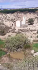
“Los cinco imprescindibles” information board
“Los cinco imprescindibles” (”The five essentials”) are five places of historical interest in the area.
Two of these places you will pass doing these routes:
I know, confusing right?!
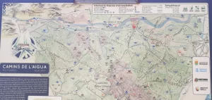
Look on the back of this board. There is a secret map hiding there, which shows you where all of these places are.
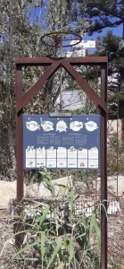
TOP TIPS for Explorers: You can use this map to find other places on foot. For example, there should be a path on the other side of the road to visit the church, as indicated on the signpost.
TOP TIPS for Explorers: I have seen El Pantanet (which means reservoir) from the road, but you cannot access it directly because there a locked gate).
However, there appears to be turnoff (actually on the crossroads) where you can pull into a gravel area to park and get a closer look.
Prefer to explore HIKING paths around a RESERVOIR?
Going down into the canyon
From the road you go down a slope. When you see a green/white painted tree, walk past it and go down there, right to the bottom where you will see a sign post.
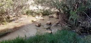
Stepping stones
To cross the river, there are some stepping stones.
This is where the wild animals live! First, I saw a turtle. Then I saw a big snake sleeping soundly in the sun. Luckily the sound of the water masked any noise I was making, so I took a few photos and snook past carefully on the slippery rocks.
So, if you want to see them, you have to be quiet, because initially I was hitting reeds out of the way and I scared the turtle away before.
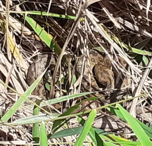
This is why I like the blue route (Assut de Mutxamel – Assut de Sant Joan) the best, out of the three routes along this river.
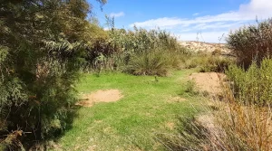
Grassy area
Just after the stepping stones, there is a lovely grassy area that would be a nice spot for a picnic or a rest after the excitement of seeing a snake.
Trick crossing
There is a crossing over the river that consists of a big pallet. This is not the route to the end.
It might have been in the past, but not anymore.
I attempted to take this ´route´ back from the end and it was TOO wild – even for me.
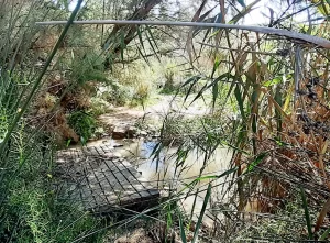
TOP TIP for Adventurers: You can use this route to go back, following the river bed directly back to the house/road. It is a wilder than the normal route, but not too difficult.
Looking for the best GUIDED TOURS to take you to hidden gems in the Costa Blanca?
TOP TIP for Adventurers: If you like wild camping, cross the ´trick crossing´ and turn left to find a lovely grassy area.
This would be great for a low-level wild camp, hidden away, with the sound of the water to fall asleep to.
Recommended gear for winter:
Heated Hooded Jacket (unisex) with 3 temperature levels
Includes 16000mah Powerbank
Secret dam
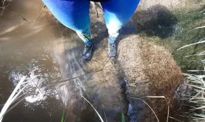
Right near the end of the route you reach what appears to be just bushes and grass!
However, if you go to the ground level concrete in front of you, you will see that this is actually another Assut (a small dam) hidden away to the right.
When I visited in June there was no water passing over it, but when I did the route in September it the flowing water was almost deep enough to cover my (size 4) trainers when I crossed it.
This is the path. However, if you don´t want to get your feet wet then you can turn back, because the end of the route is just two minutes away on the other side of the river, and you are not really missing out on anything.
Looking for more adventure? Scramble up a gully to reach the summit of Cabeco dor
The end of the route
This is the end of the route, and a potential parking spot if you would prefer to start the route here It is a gravel area that would accommodate a few cars.
TOP TIP for Adventurers: If you like scrambling, there is a big rock near the end that will give you a good view of the canyon.
Escaped dog!
On the way back, after the second difficult path, a big dog appeared out of the bushes with a broken chain attached to its lead. It had obviously escaped from the house above. It was not dangerous. It was just surprised to see me, and then scared. So, I said some nice calming words, continued slowly, and the dog slowly moved out of the way.
Return the wild way!
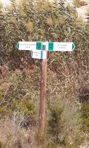
Instead of going back up onto the road, I followed the sign that said “Assut de El Campello, 150m” which leads you back through the canyon and to the big waterfall.
However, I have no idea where the Assut de El Campello actually is…If it was there I didn´t see it! (perhaps because it was so overgrown).
TOP TIPS for Adventurers: This route is for you!
It is not for the feint hearted. Find out more…
Reeds
The initial part of this route is very overgrown just looks like reeds. You have to simply walk into them and see if you can wade through them. Don´t worry – you can.
You will end up in a tunnel of reeds with a small river on your right…
River crossing
Once in the tunned you will reach the river on you right is also covered in reeds!
If you peek through the reeds, you can see a green/white painted rock indicating that the path is on the other side So, you need to cross!
I crossed directly in front of the rock, which involved fighting with the reeds, and getting wet feet.
More reeds!
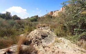
Once you escape from these reeds, you will see a big slab of rock to your left.
Follow this rock and walk directly up the canyon where you will need to wade through the the reeds! The path (which you can´t see in real life, but you can see if you follow my recorded route) veers to the left, so make sure you head that way.
Living on the edge
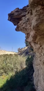
The path now follows the canyon wall on the left-hand side.
Warning! You need to ascend quite high up on the steep slope in a couple of places, with a big drop down to your right, and unstable ground.
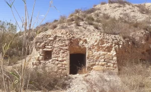
TOP TIP for Explorers: Crawl through the cave house!
Final river crossing
You will reach a pretty little area from which you will see the see the building and the pool.
You need to cross here, as it is the easiest place to cross.
I used the stepping stones, which are actually rocks that move, so I got my feet wet (again).
From the waterfall
You can get close up to the waterfall flowing over the Assut de Sant Joan for some AWESOME photos! (although initially it seems hidden by reeds).
Just walk to the right-hand side and access via the rocks.
Then you need to scramble up the right-hand side of the canyon (the photos are great from there too), then return by crossing the middle of the grassy area above the waterfall.
From the Assut de Sant Joan, you can also do a second linear route: Assut de Mutxamel – Assut de Sant Joan (SL-CV 154).
You could do these two routes together:
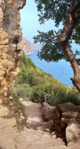
If you would prefer an easier coastal hike with a guide and transportation from Valencia, I recommend this route along the Cliffs of Benitachell (Cala Moraig to Cala Llebeig).
I did it last year and it is SO beautiful, with the cliffs an crystal-clear water below, lush mountains and incredible views…
Why not buy me a coffee
to keep me going on adventures
so that I can share them with you!
Wild Child Costa Blanca
